Informal Settlement
Term Penn State LArch 414 Spring
Course Rio Informal Settlement Shape Grammar
Instructor Jose Duarte
Partner Lauren Shoats, Siavash Varasteh
Look into one of these settlements located in Rio de Janeiro in Brazil, the studio attempted to solve such complex problems using a computational design approach. The ultimate goal is to fully integrate it with the rest of the city by reinforcing structural stability, strengthening social activity, creating and enhancing open space, and developing the landscape as ecological infrastructure.

Background
The World experiences a significant growth in population coupled with fast urbanization processes puts an enormous pressure on cities giving rise to numerous social, infrastructural, ecological, and urban problems. The formal sector is unable to provide enough appropriate dwellings to this growing population, who then resort to self-help processes giving rise to informal settlements.
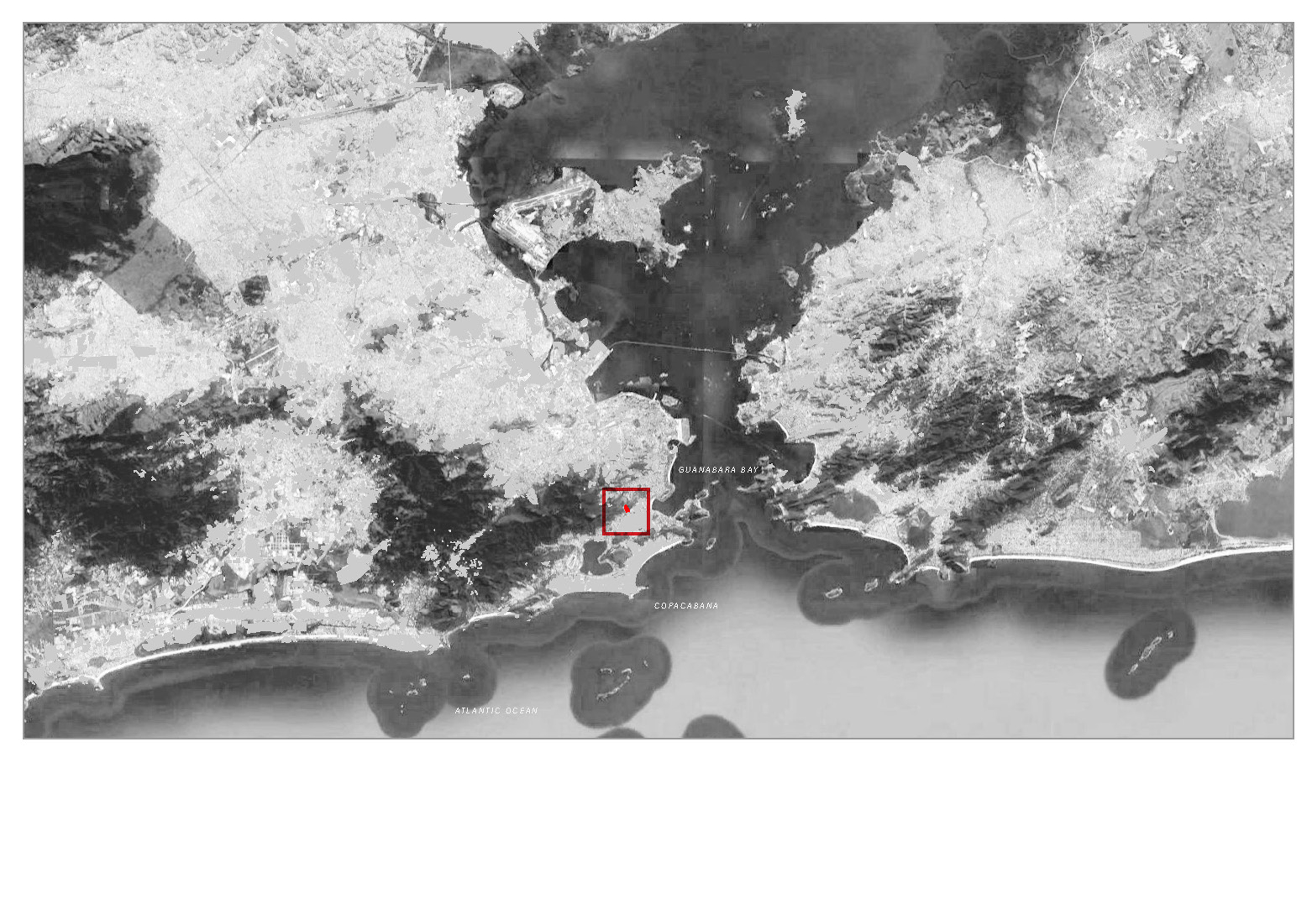
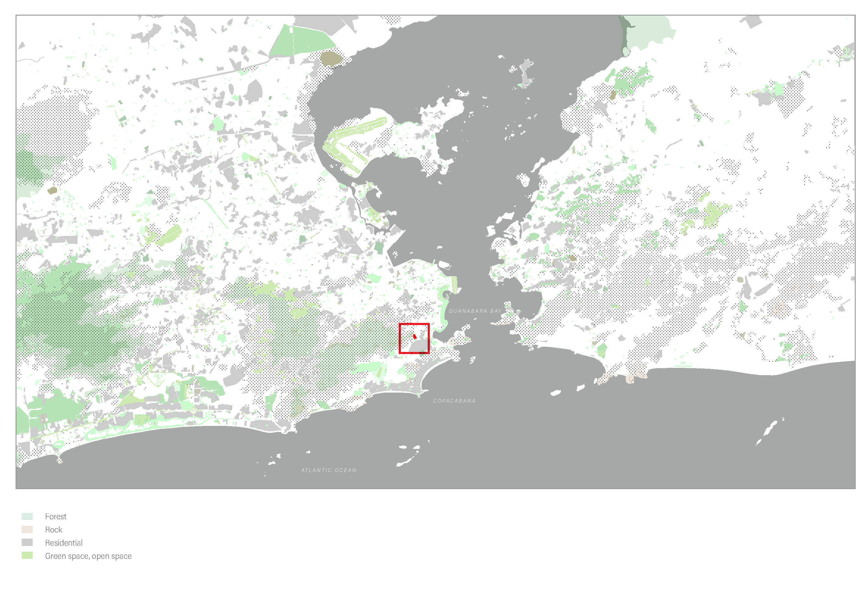
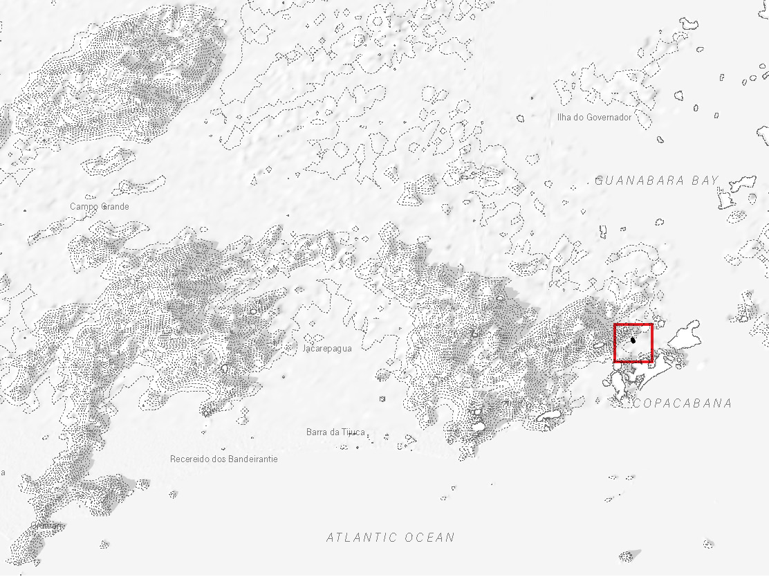
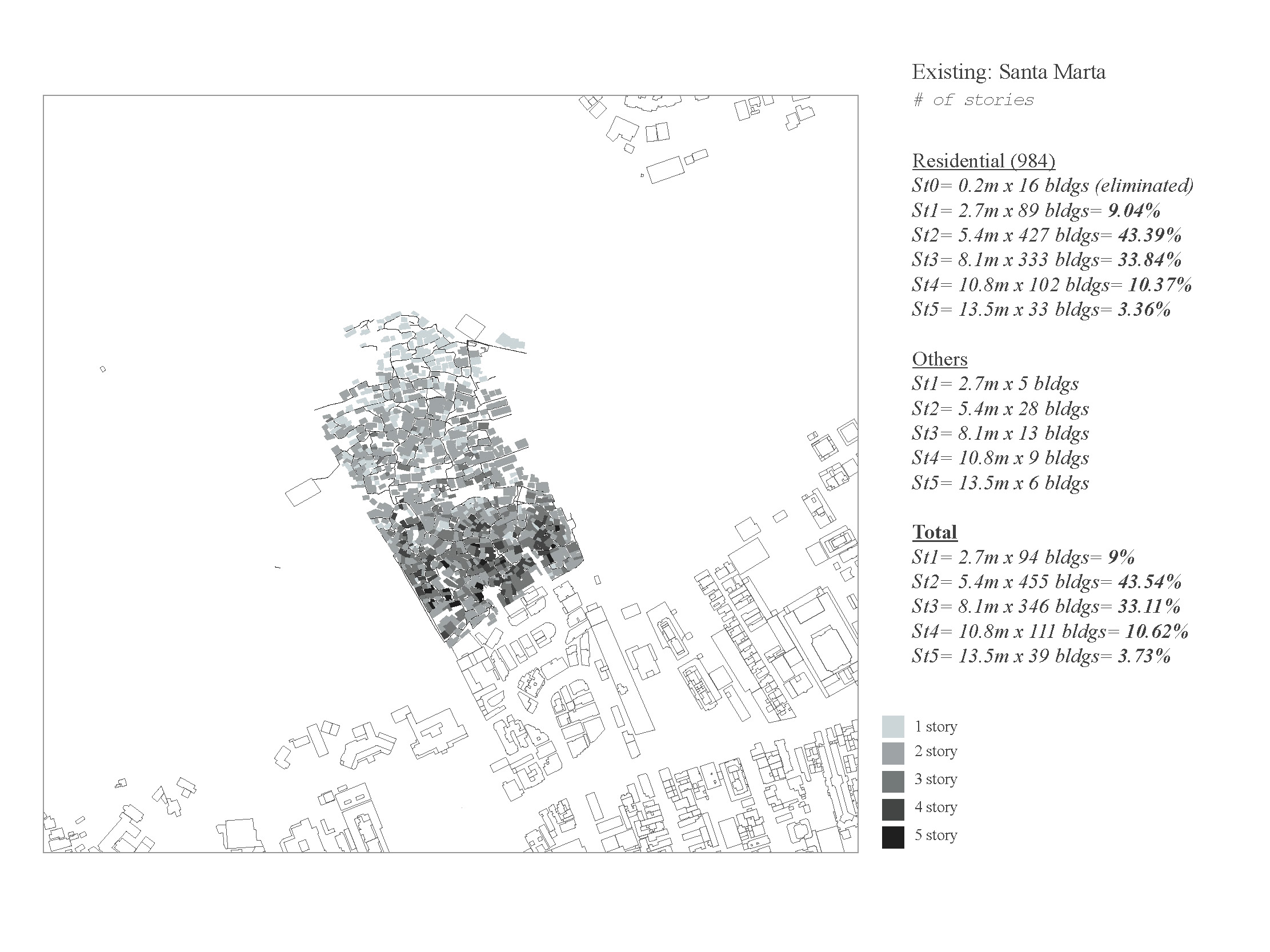
Traditionally, informal settlements have been segregated from the formal city but concentrate a significant part of the urban population growth. This study considers the informal settlement of Santa Marta, which has been occupied since the mid-1920s, on Dona Hill in the Botafogo region of Rio de Janeiro. Unpacking, analyzing, and synthesizing the contextual opportunities and constraints between formal and informal sectors will be key in developing successful solutions to the growth and integration of Santa Marta with the rest of the formal city.
Link to the studio website
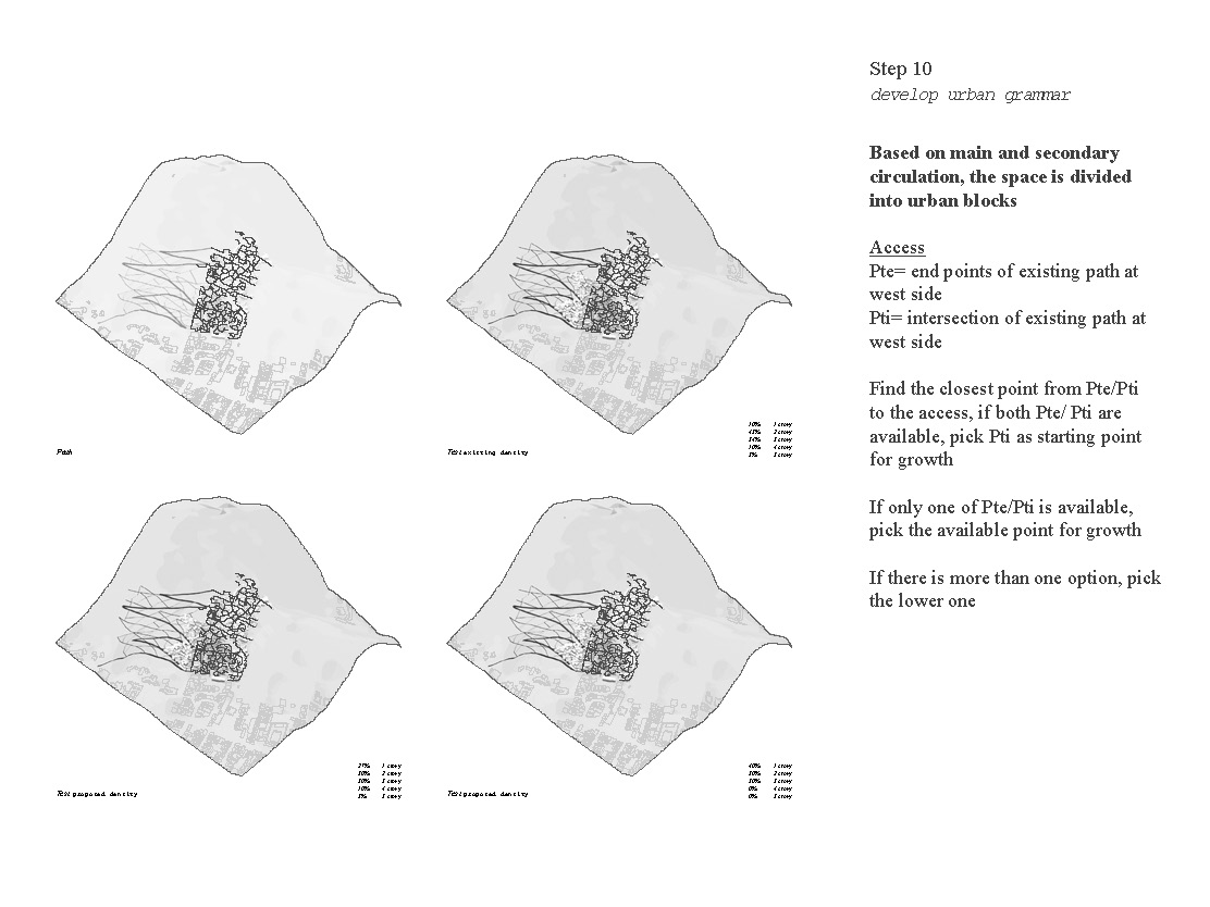
Site Analysis: Mapping
1. Location
2. Circulation
3. Natural Resources
1. Location
2. Circulation
3. Natural Resources
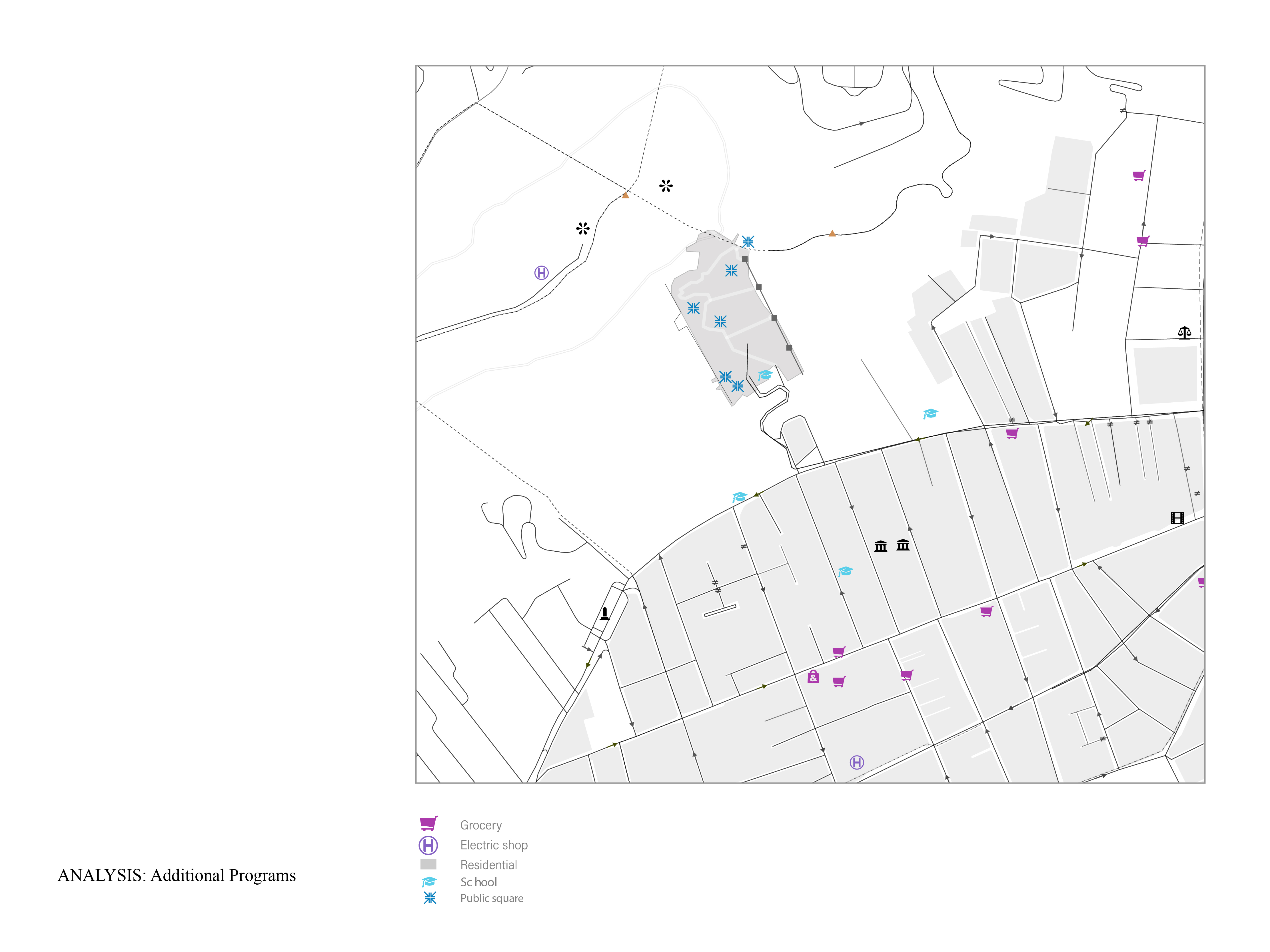

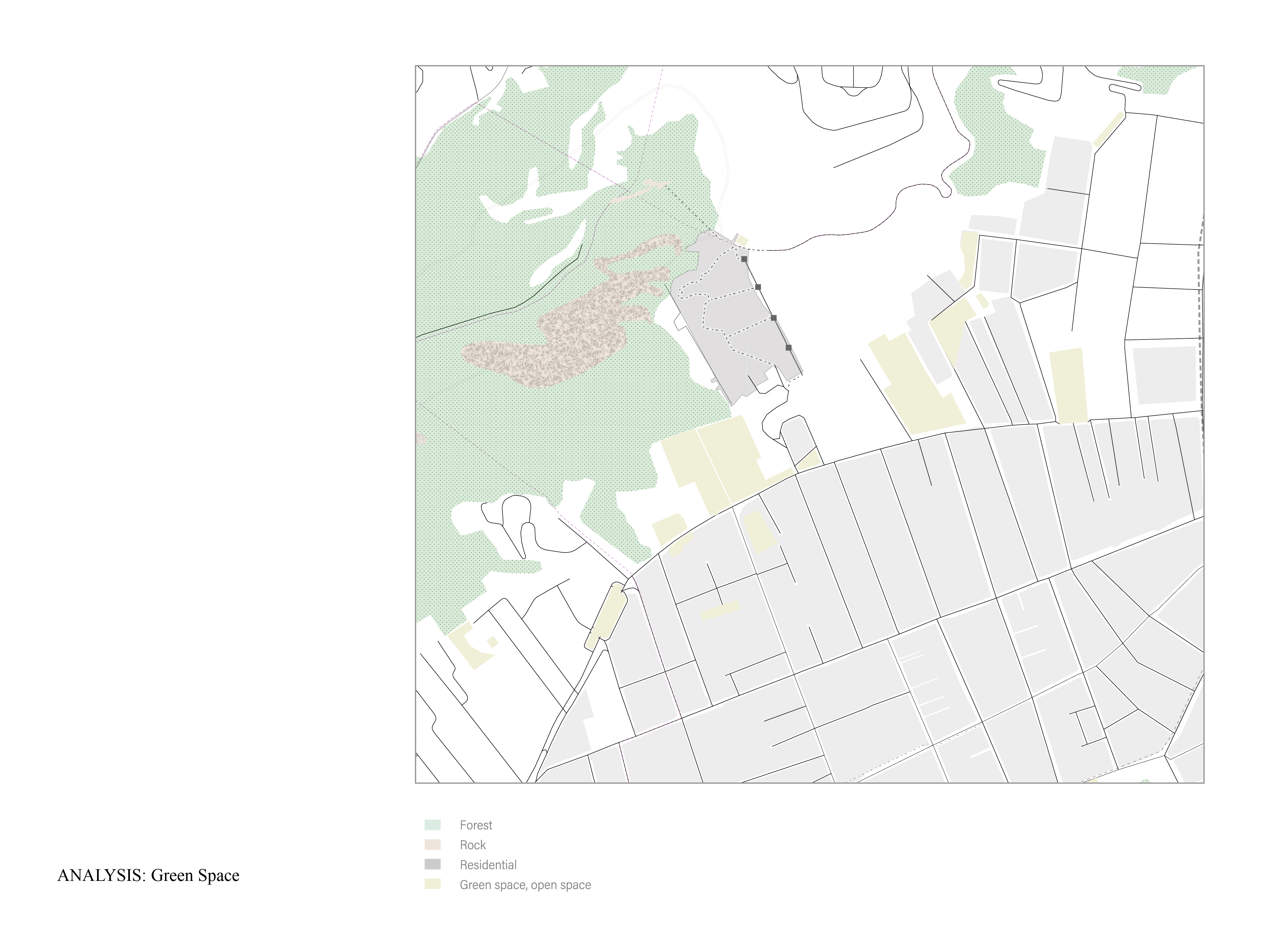

Site Analysis: Zoom in site
1. Additional Program
2. Slope and site selection
3. Green space
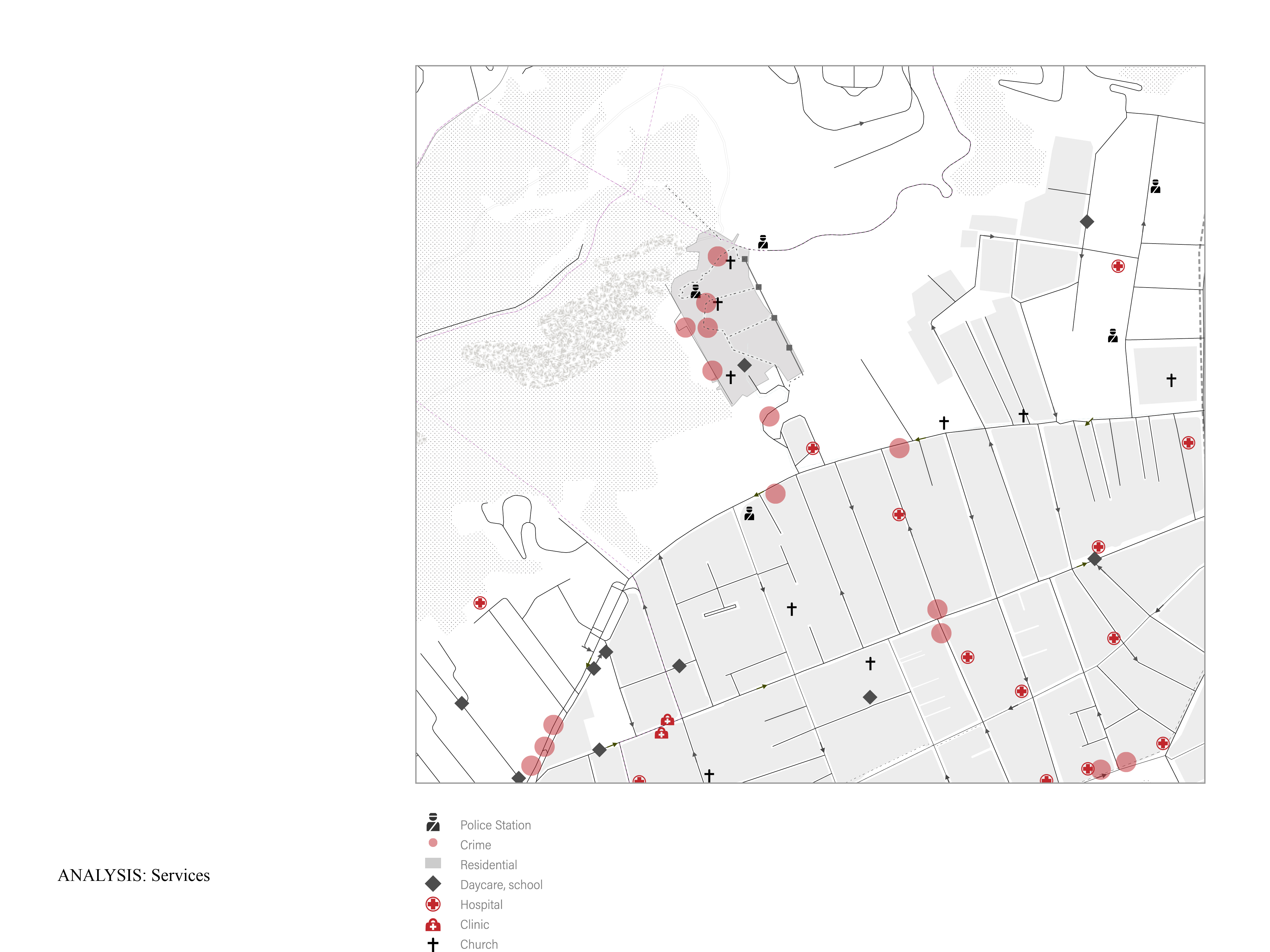
4. Services
5. Circulation & barrier
1. Additional Program
2. Slope and site selection
3. Green space
4. Services
5. Circulation & barrier
Site Analysis
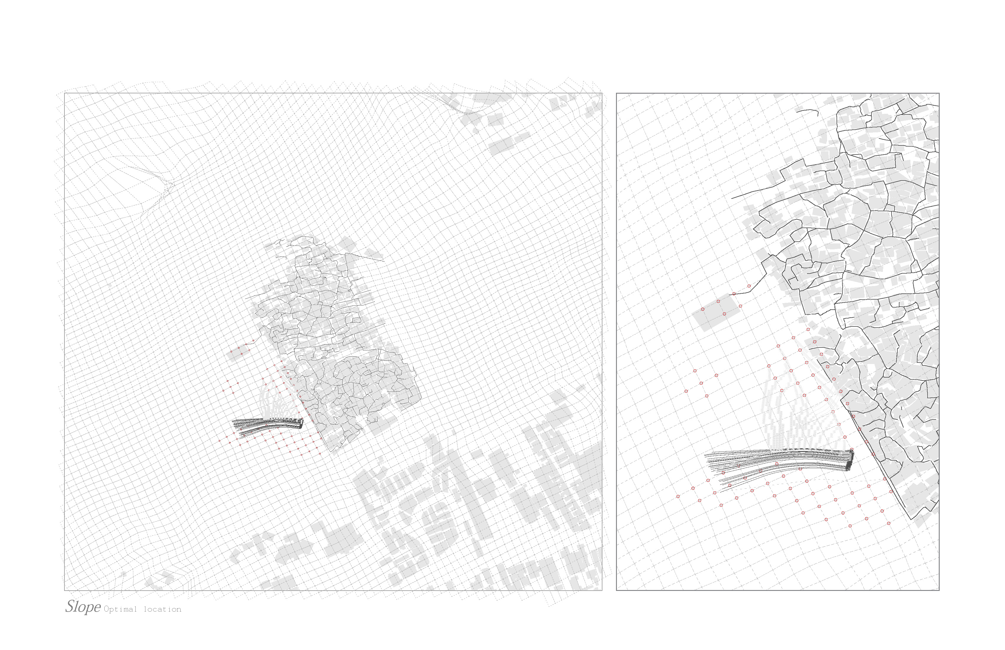
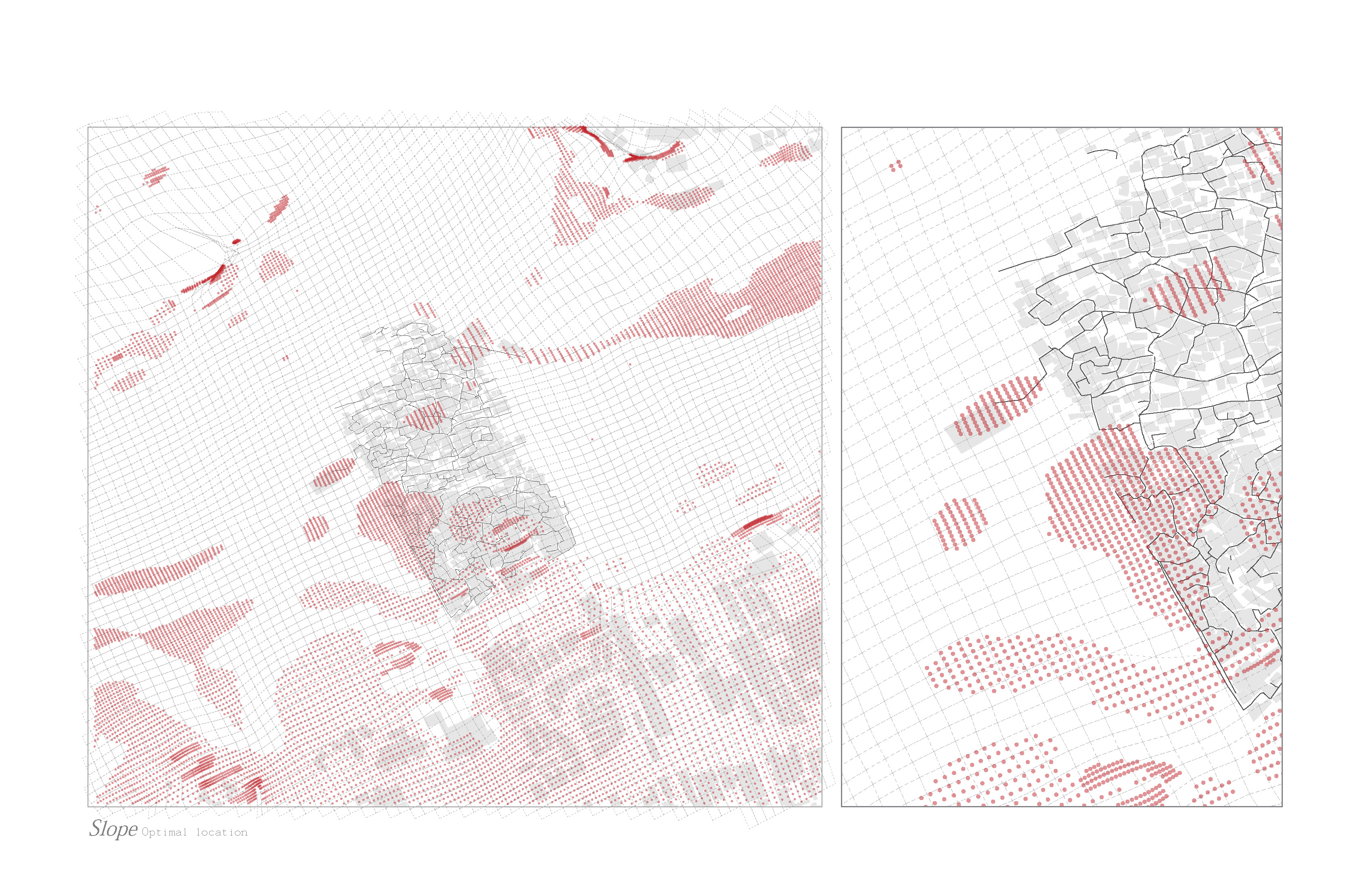
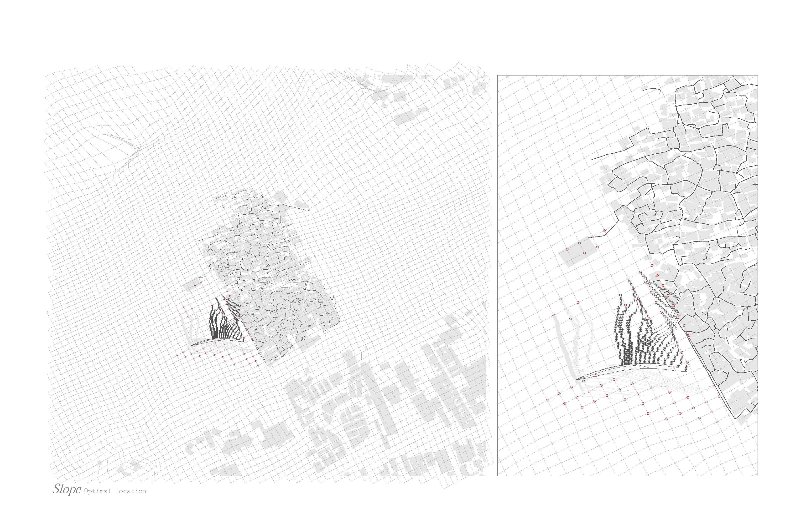
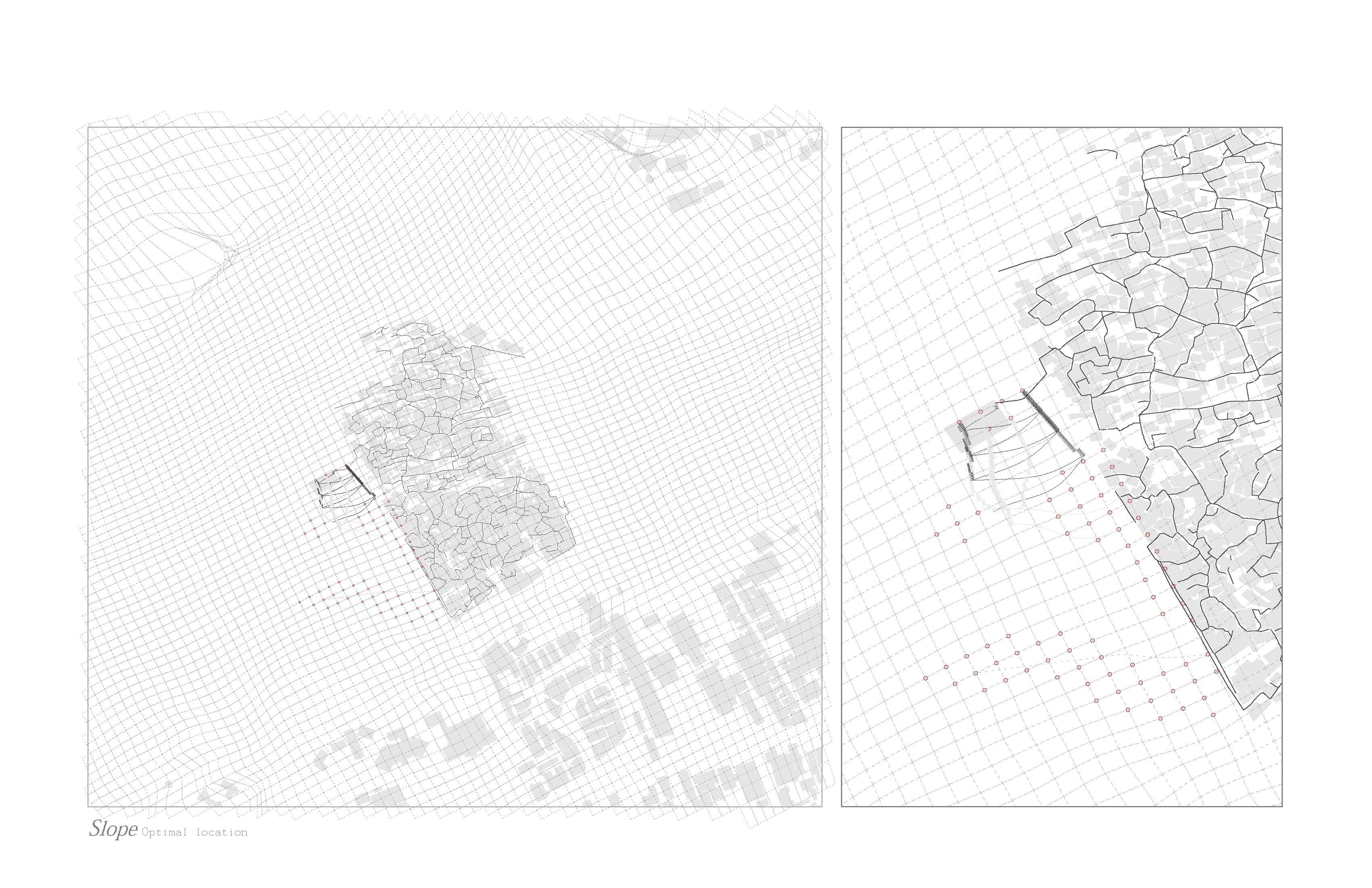
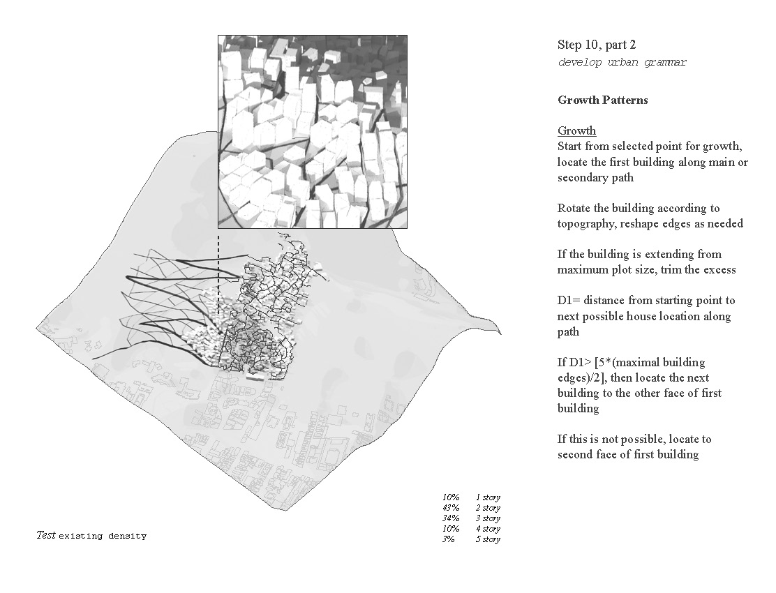
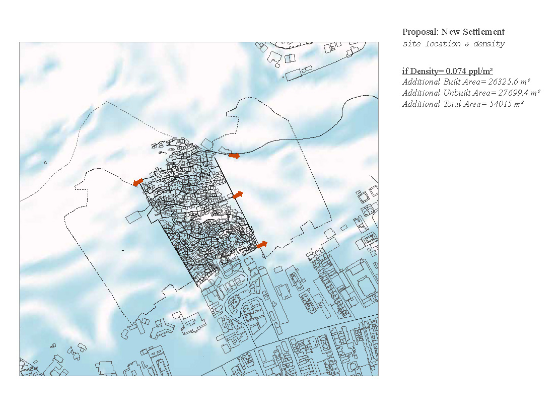
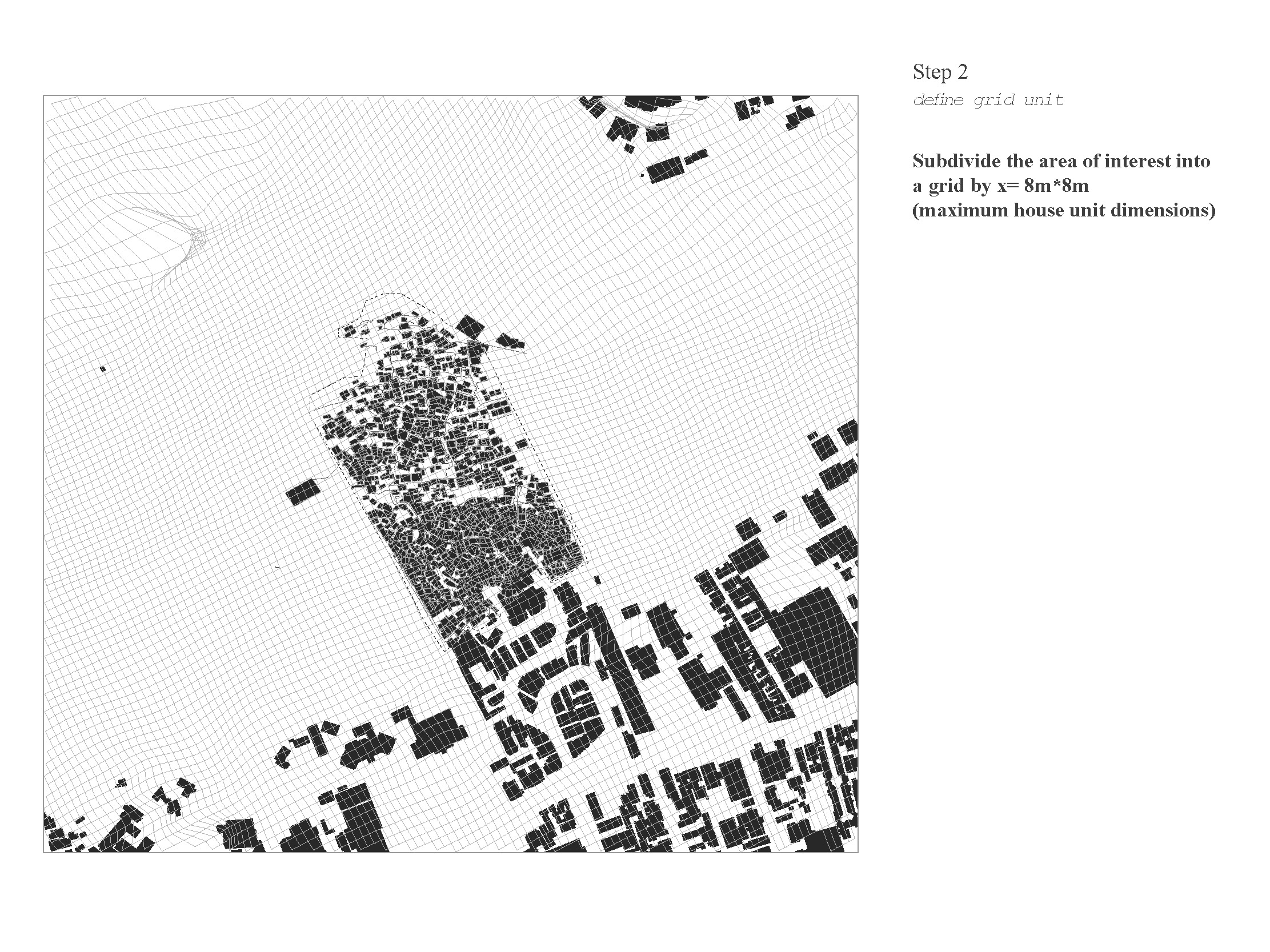
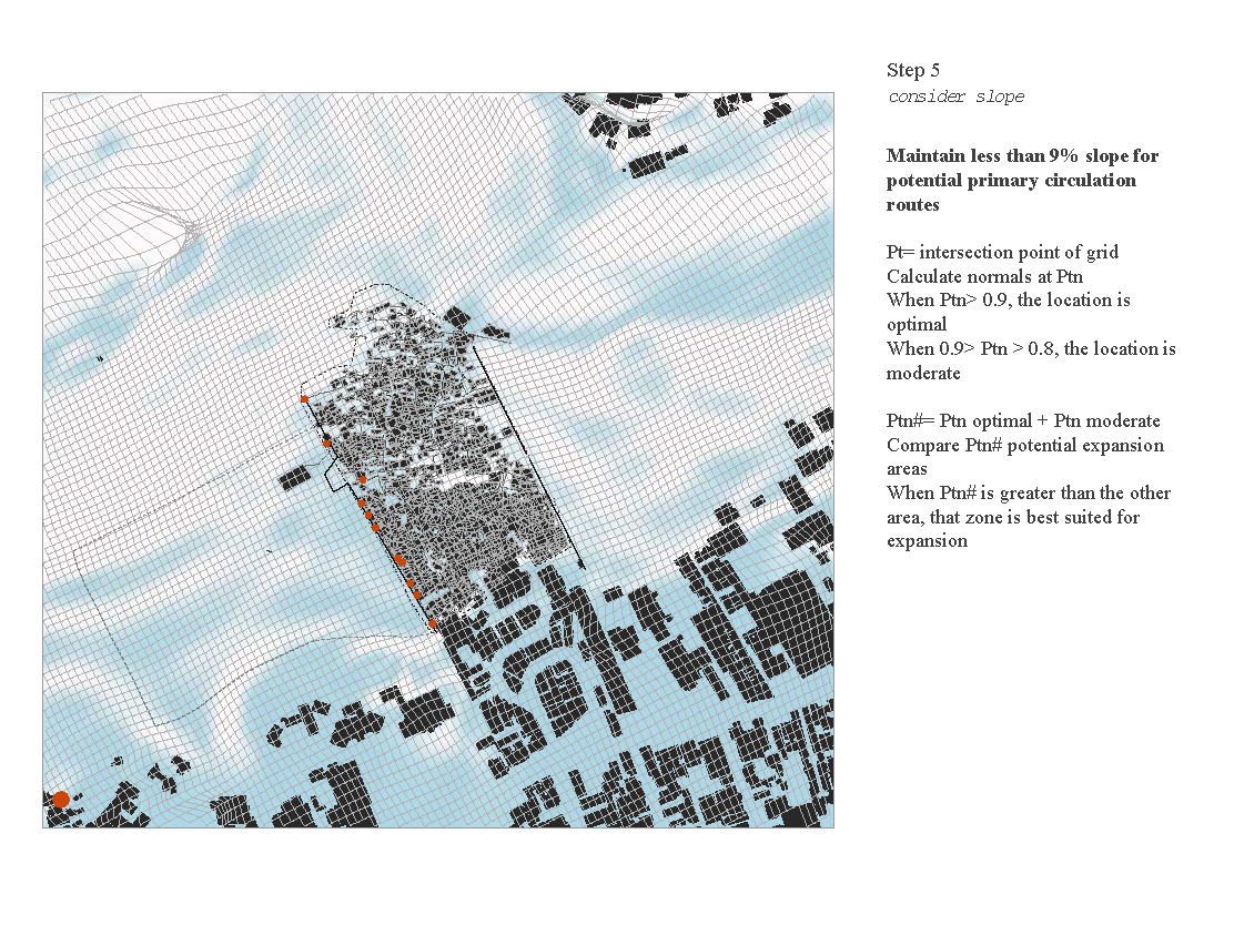
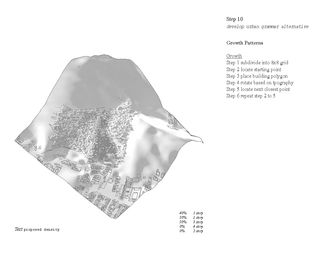
The task began by studying Santa Marta and its adjacencies at greater depth. Slope became the driving factor in our concept however amenities, programs, open space, barriers, and access were also important factors. The topography led us to chose the Western site, as it had the most optimal slope patterns. We determined this through use of a grid and point slope calculations. Conclusions from A01 help guide decisions moving forward with a development strategy capable of adjusting to need of the residents overtime.
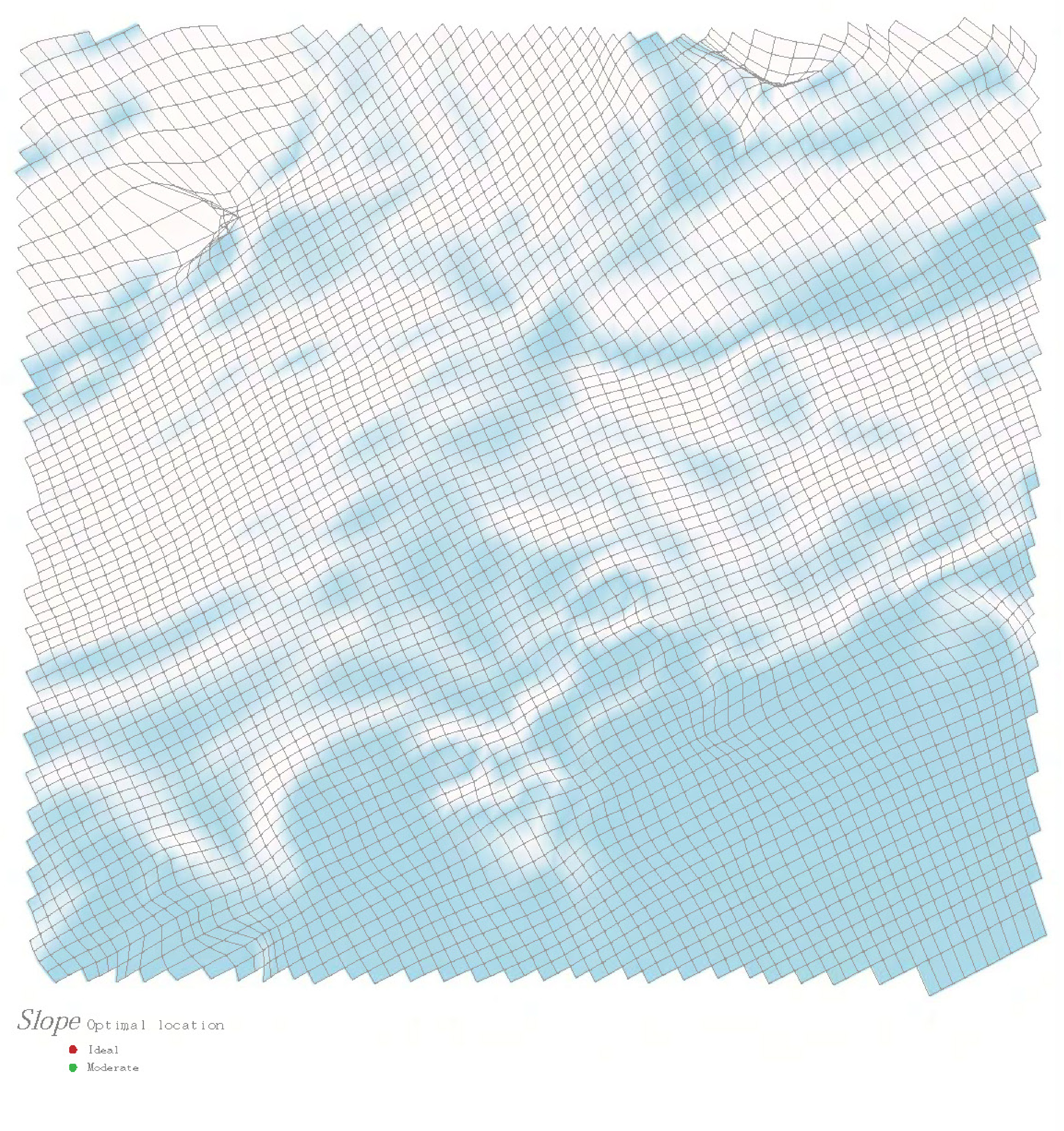

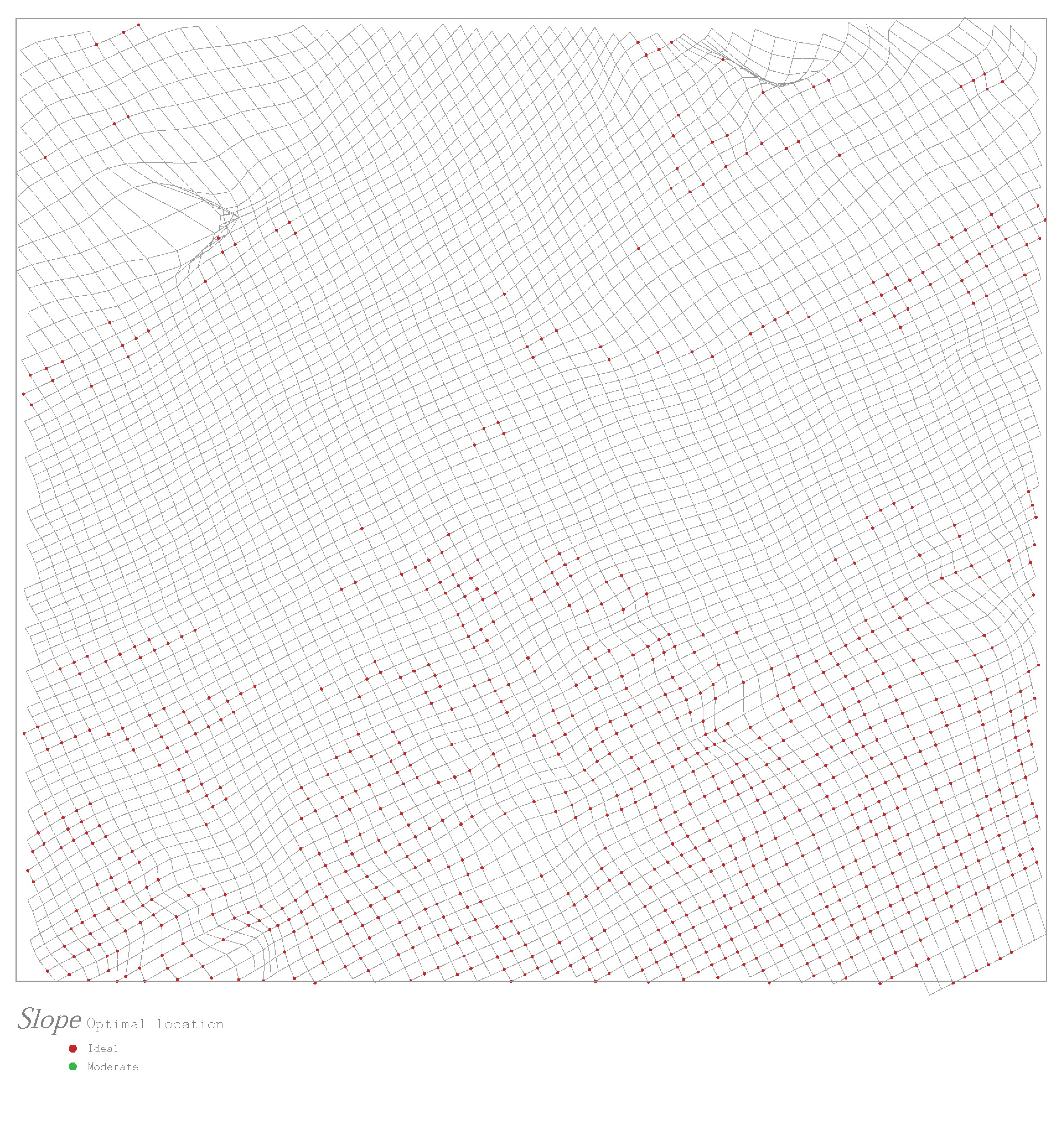
Site Analysis: Slope
Grid system to identify the ideal location for site selection
Grid system to identify the ideal location for site selection
Goals
With the site chosen and conclusions regarding the site finalized, we established several goals to be met by the new favela. Our leading goal is to improve site accessibility, doing so the steep hillside will be easier to traverse. In addition the new community will have new additional site amenities that the current neighbor lacks, an integrated path system with existing circulation, and more public open space.
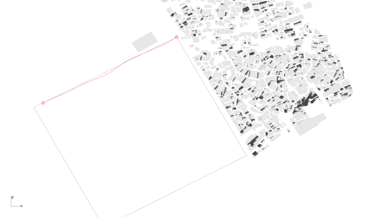
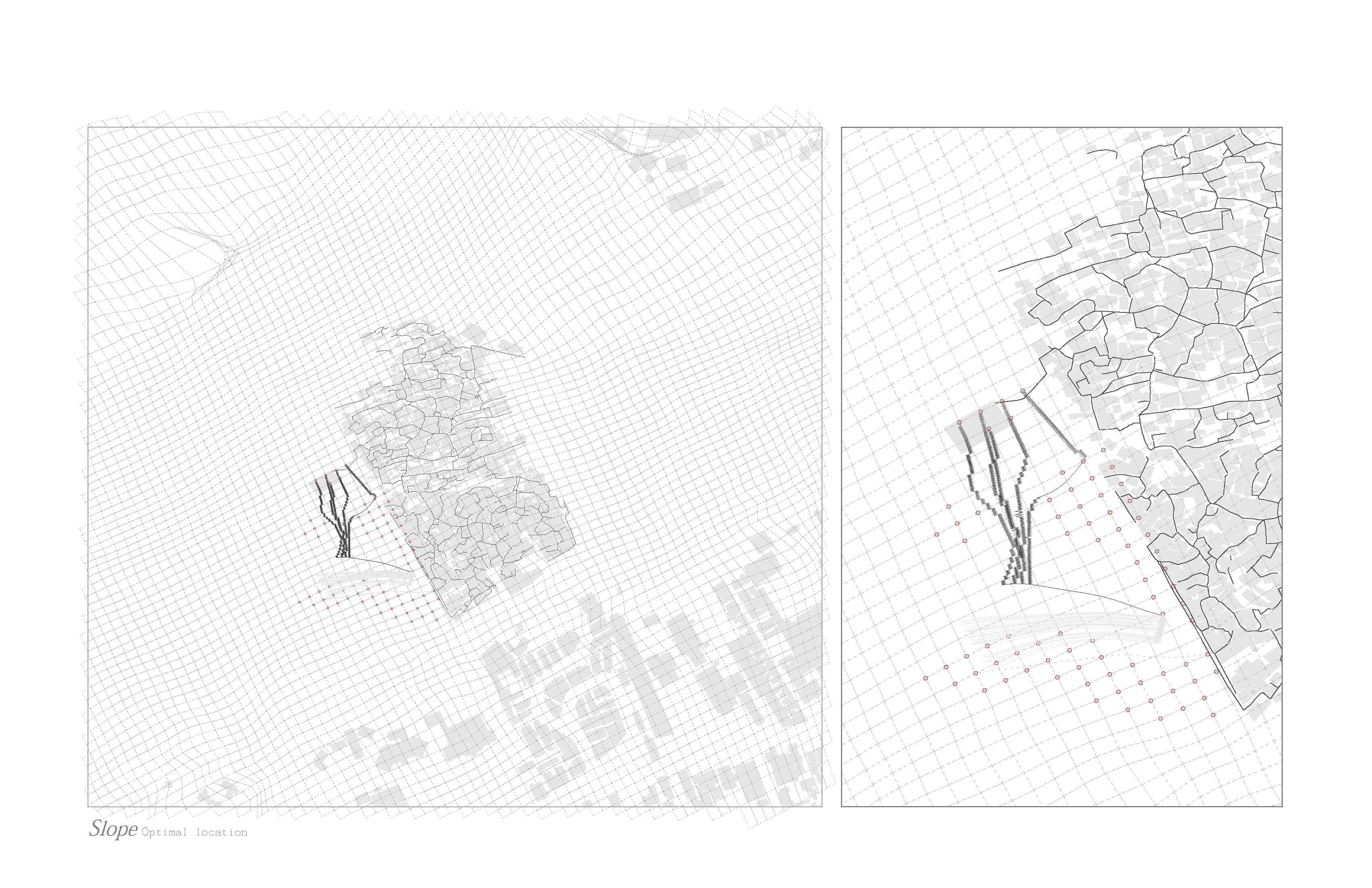
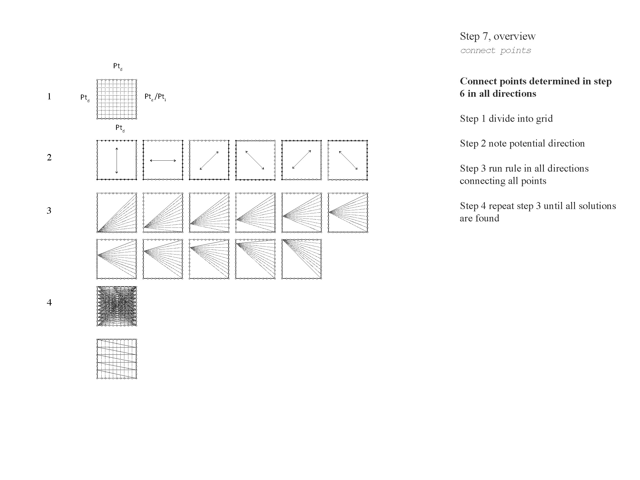
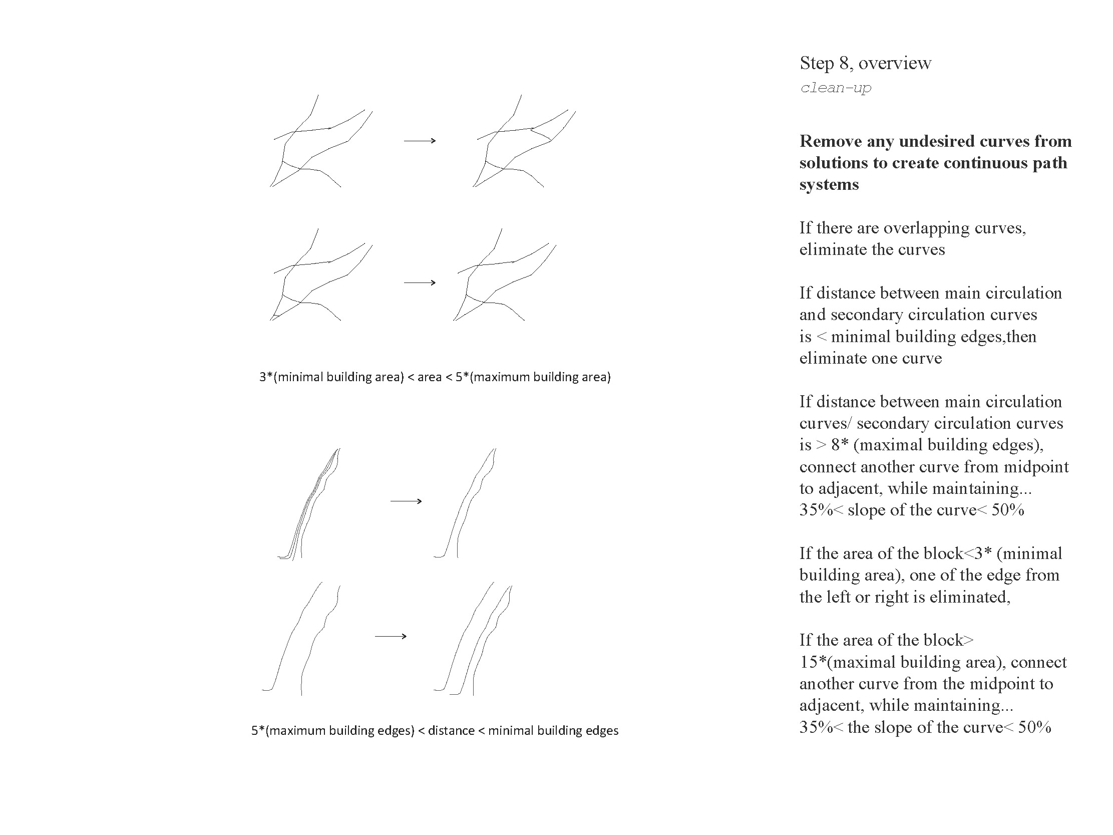
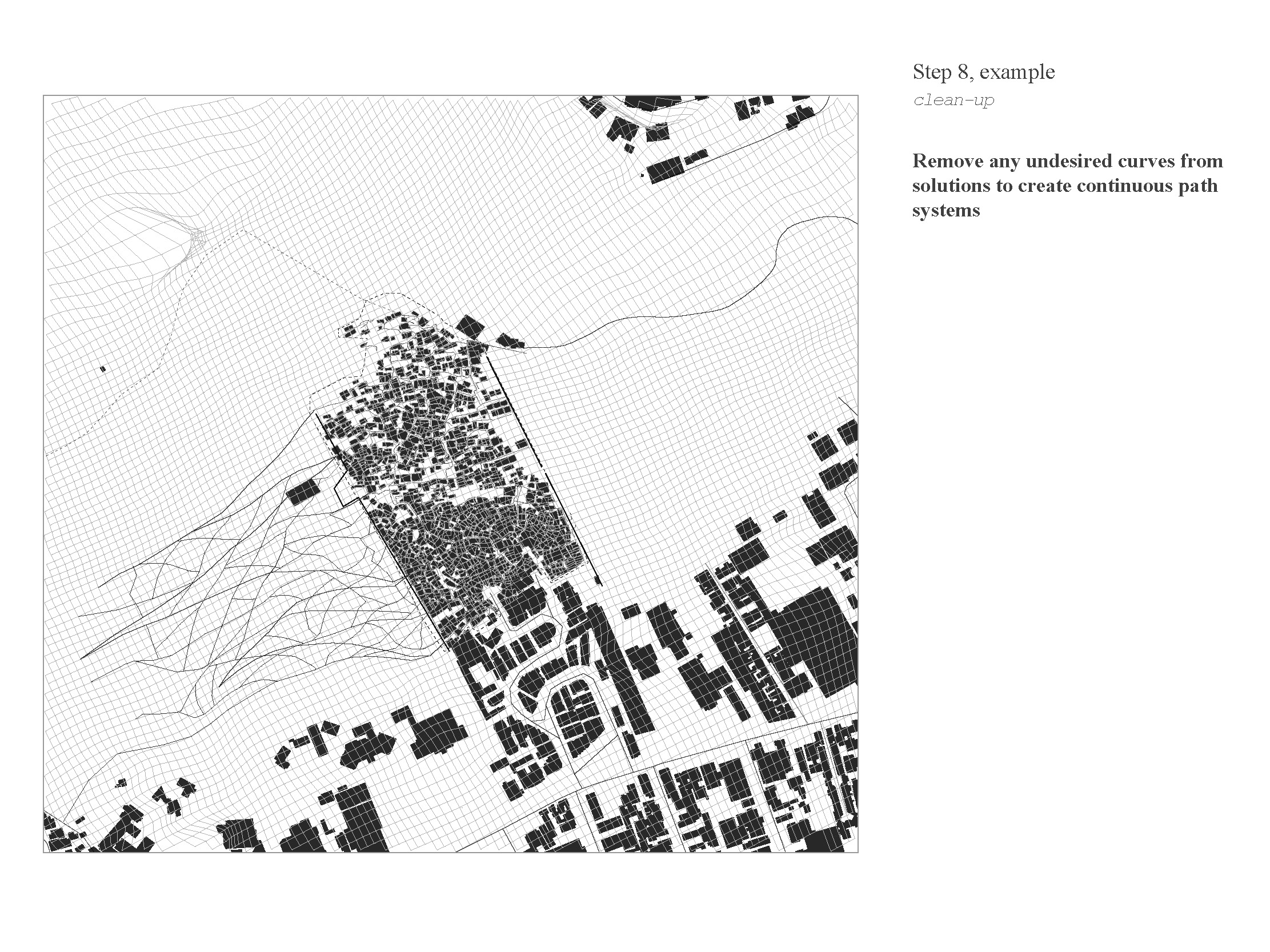
Recursive Path Finding
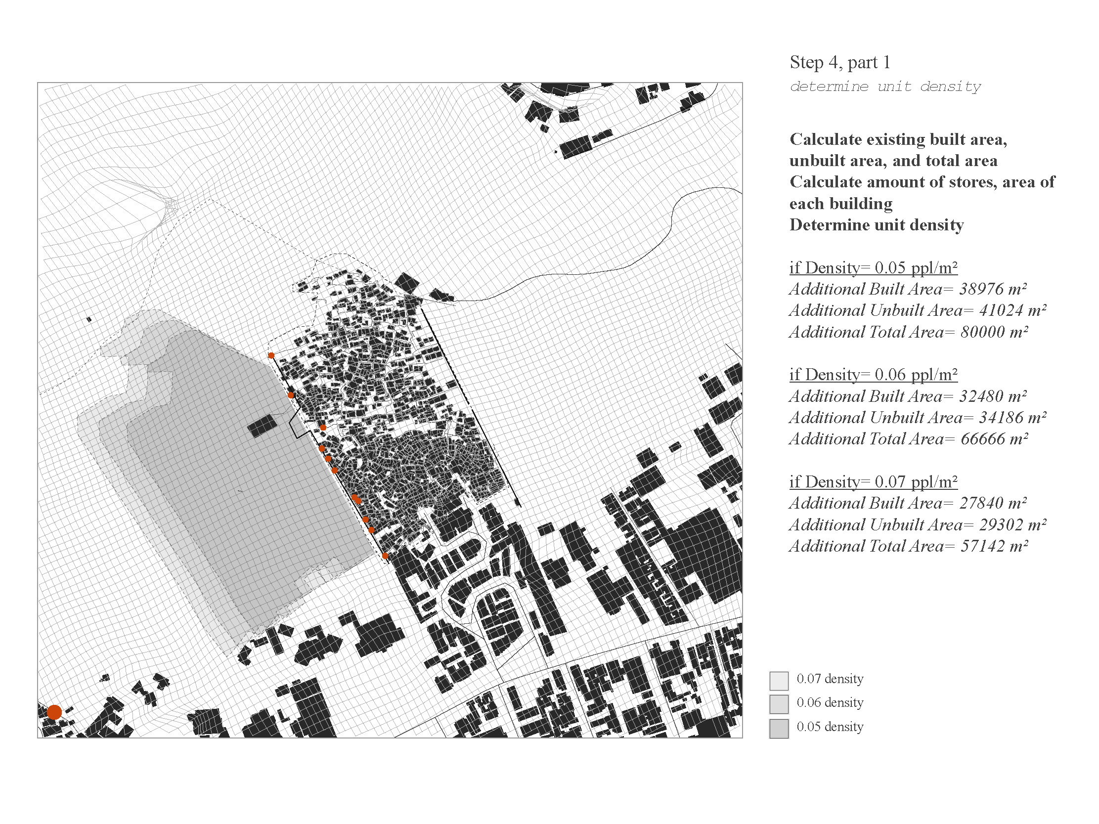
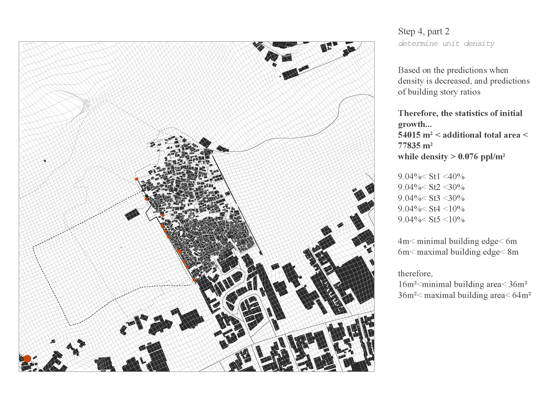
Based on the results from the optimal location calculation, the left side of the favela appeared to be a better side for the expansion.
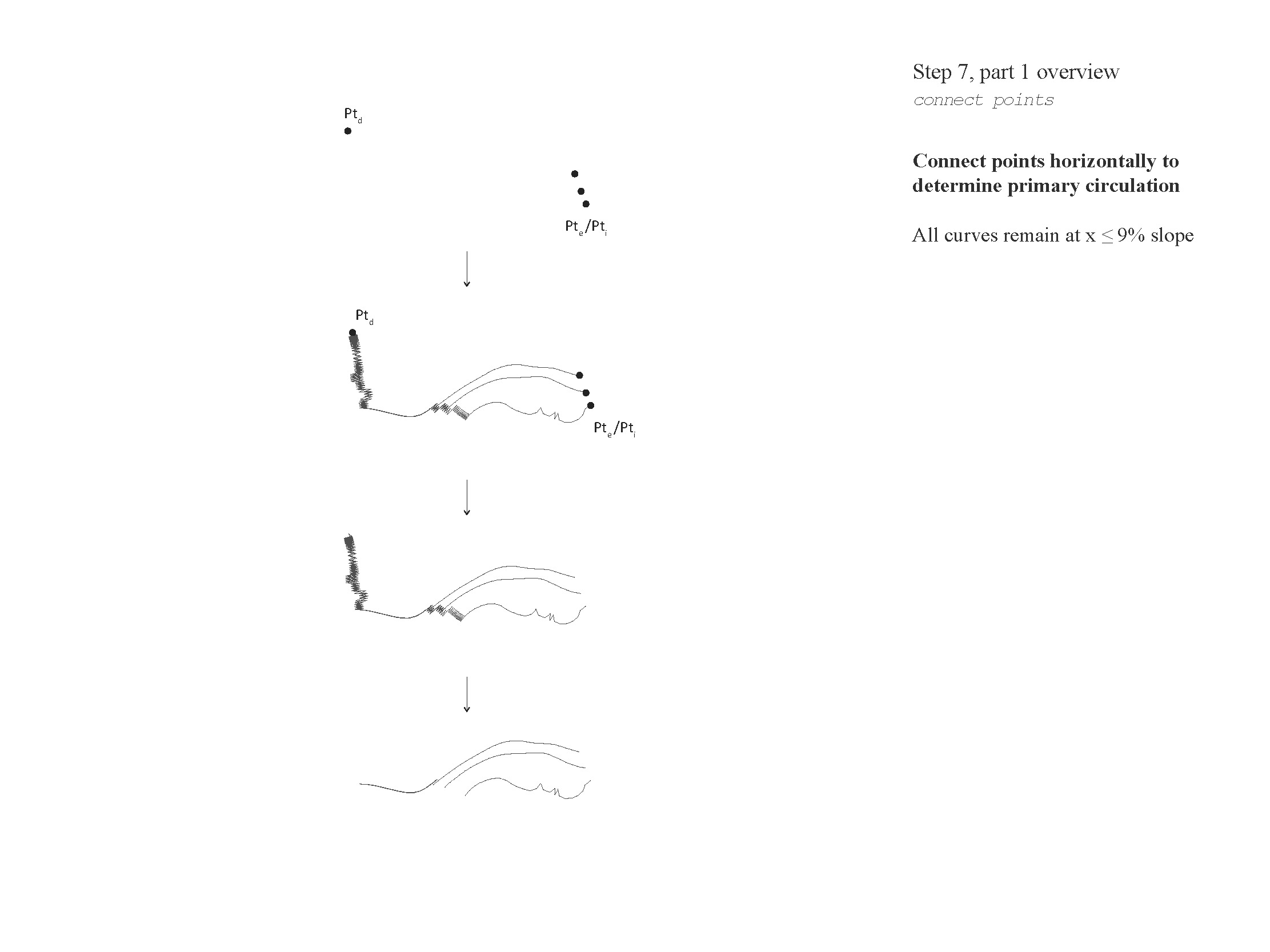
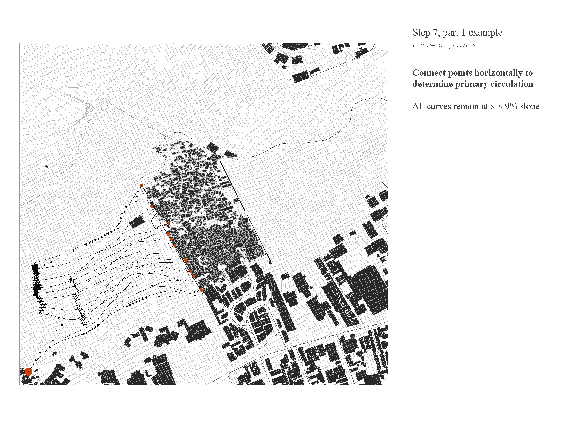
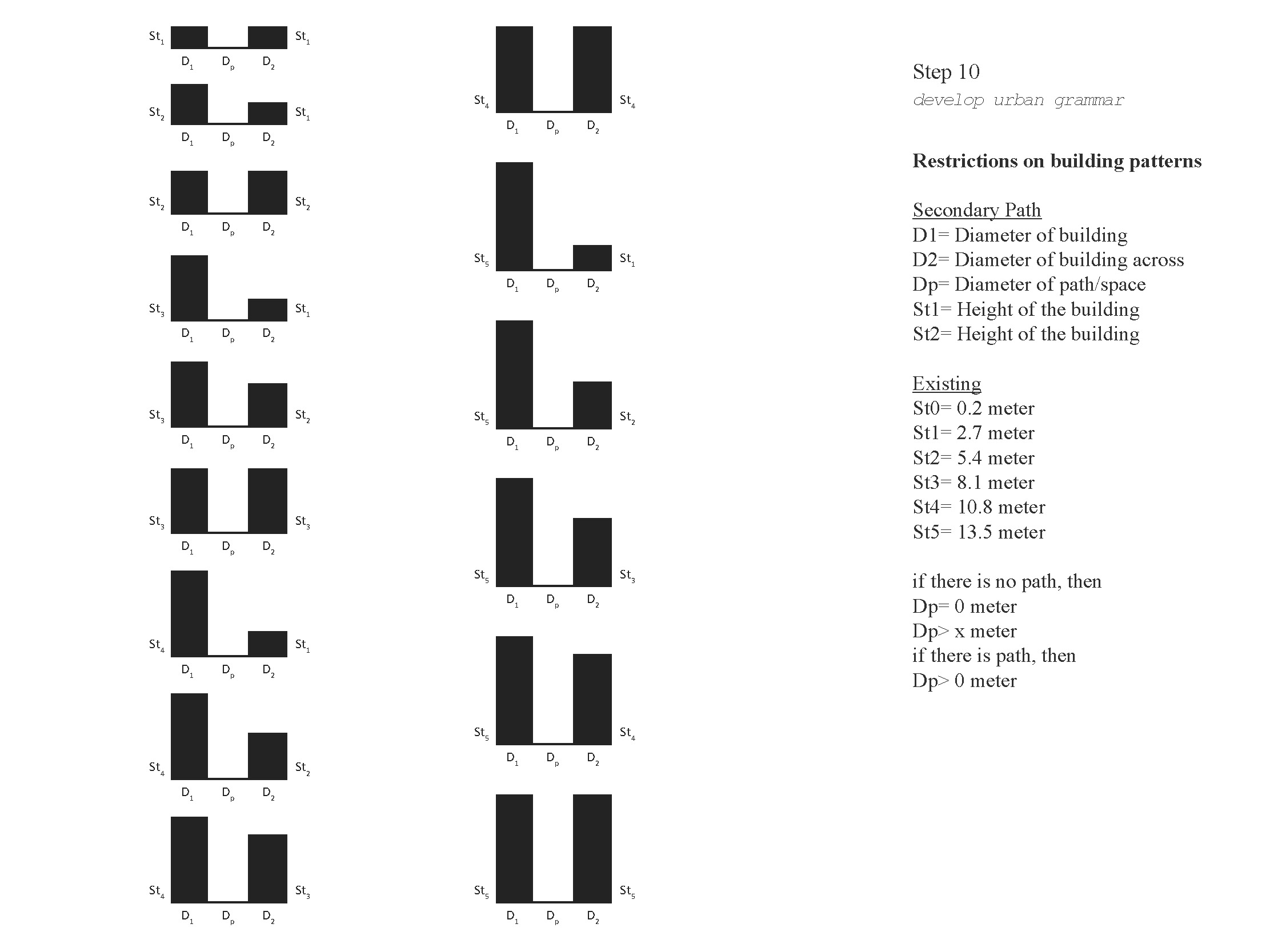
Recursive path finding script is developed to actively find routes under defined slope. Through linking the optimal locations with the recursive path finding script, the slope of the circulation route is controlled under 9%.
Recursive path finding script is developed to actively find routes under defined slope. Through linking the optimal locations with the recursive path finding script, the slope of the circulation route is controlled under 9%.

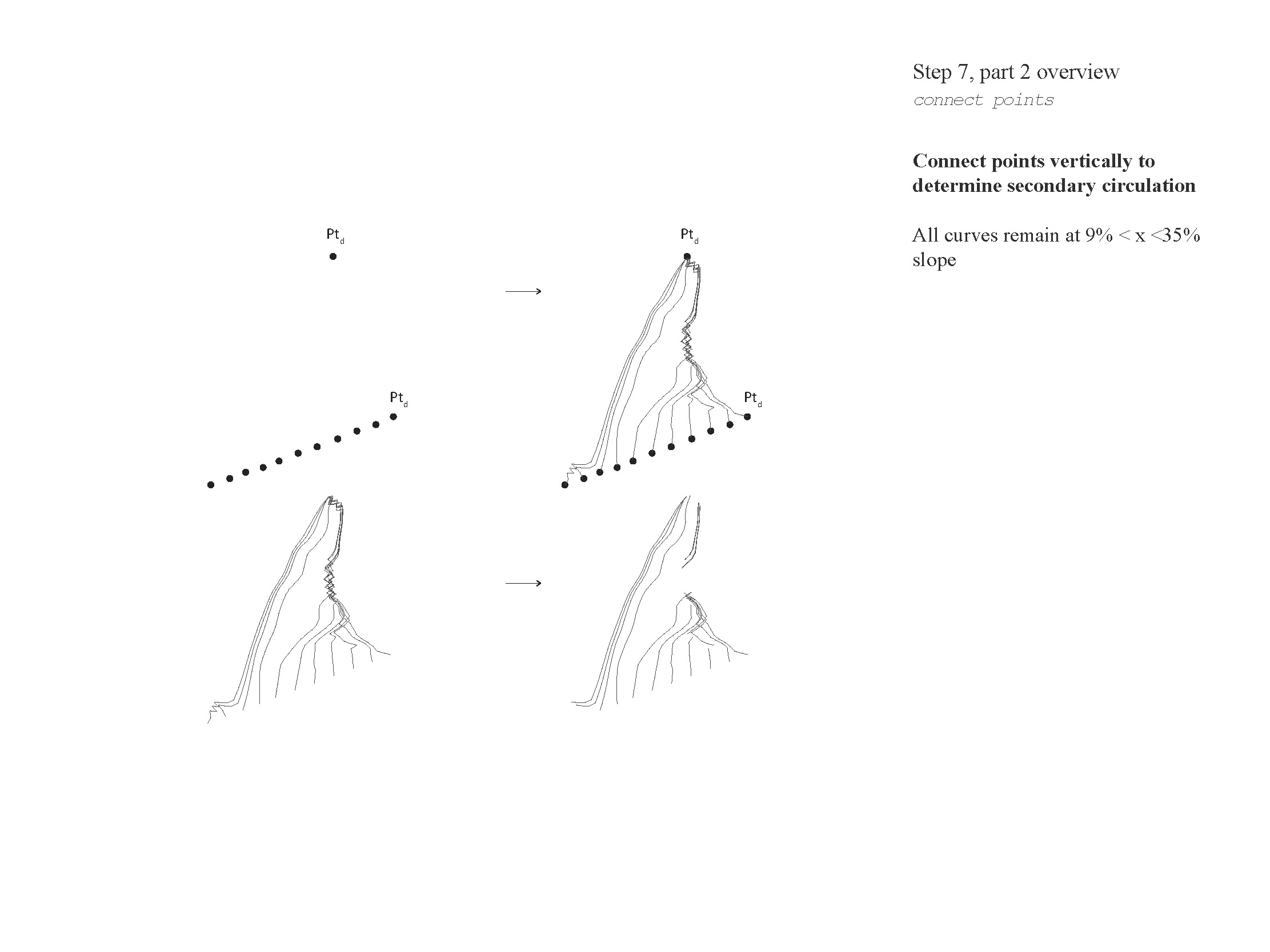
Diagram: Linking the optimal location with recursive script


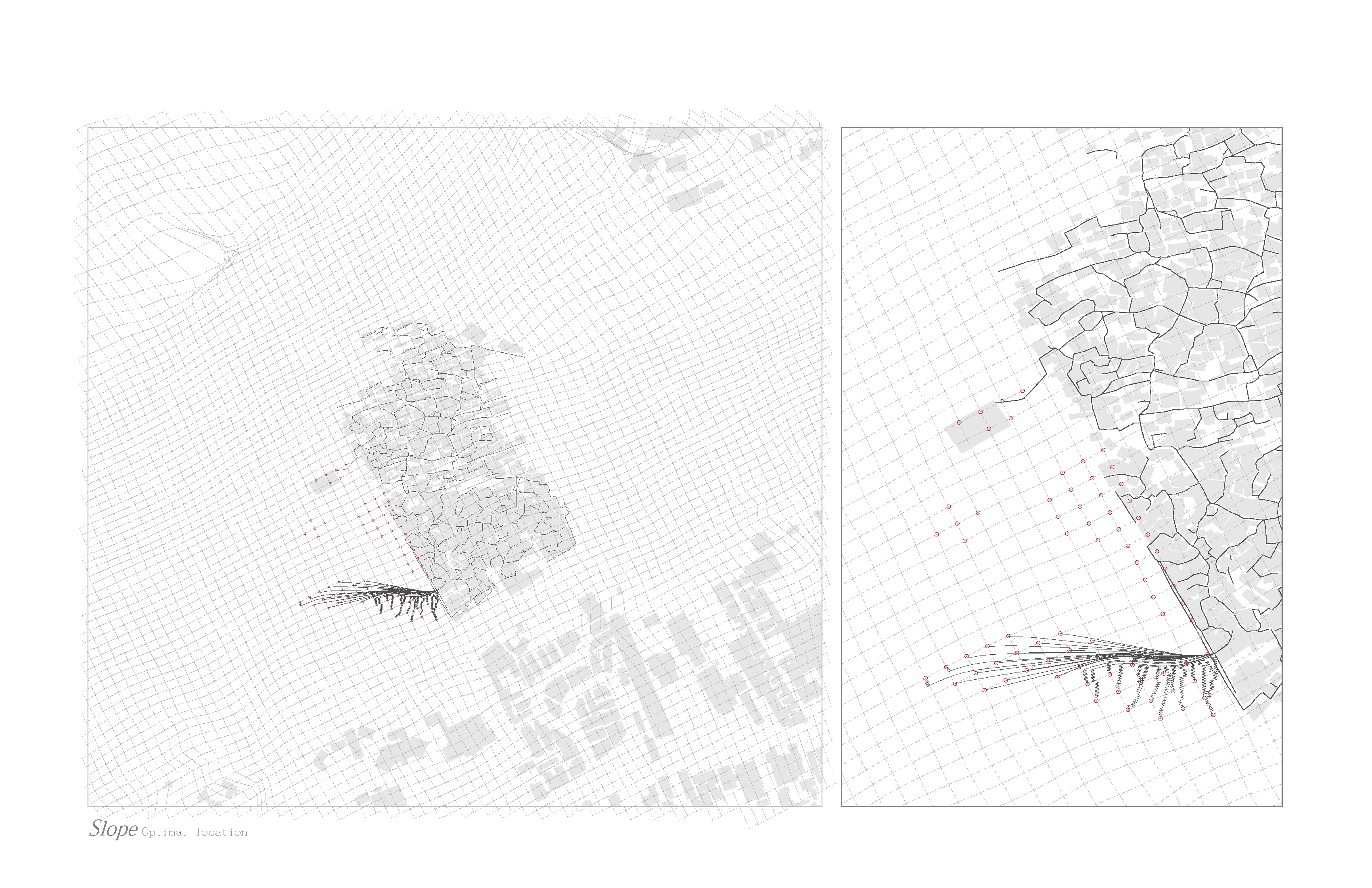


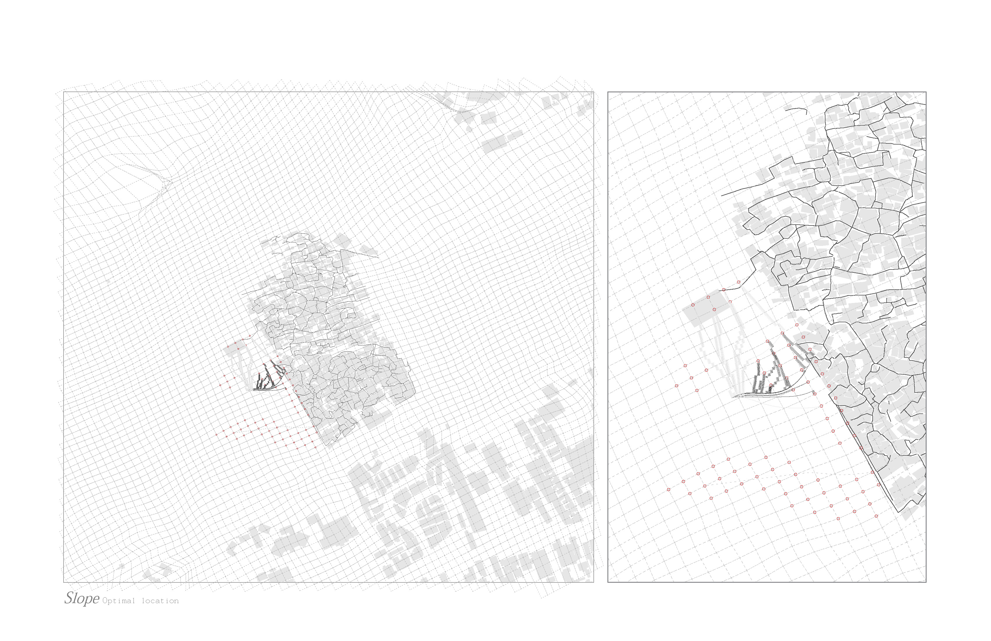


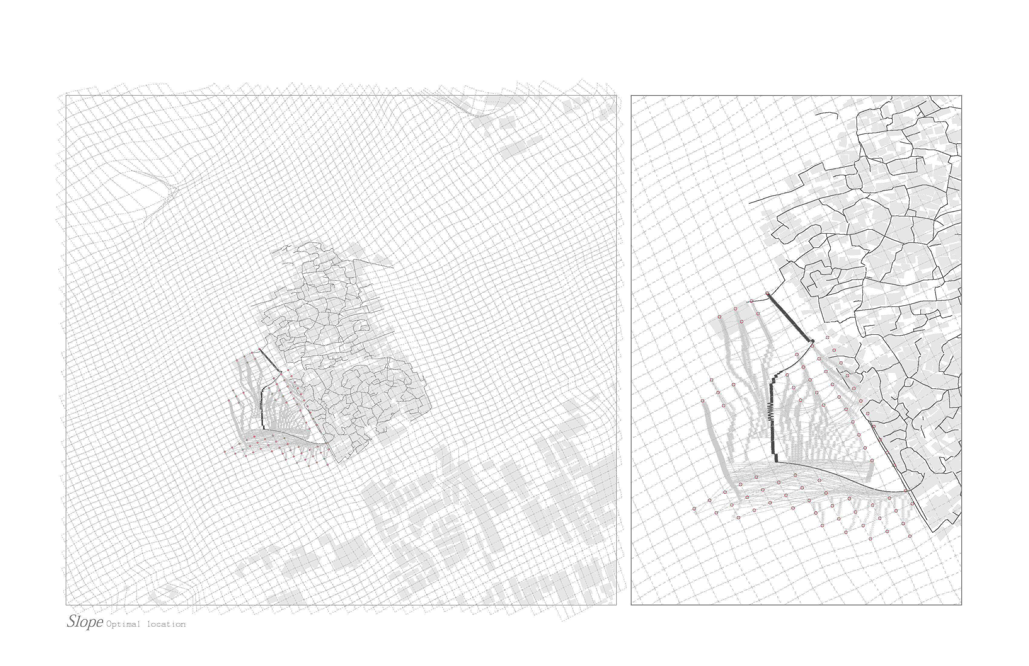

Map: Algorithmn is used on the left side for expansion
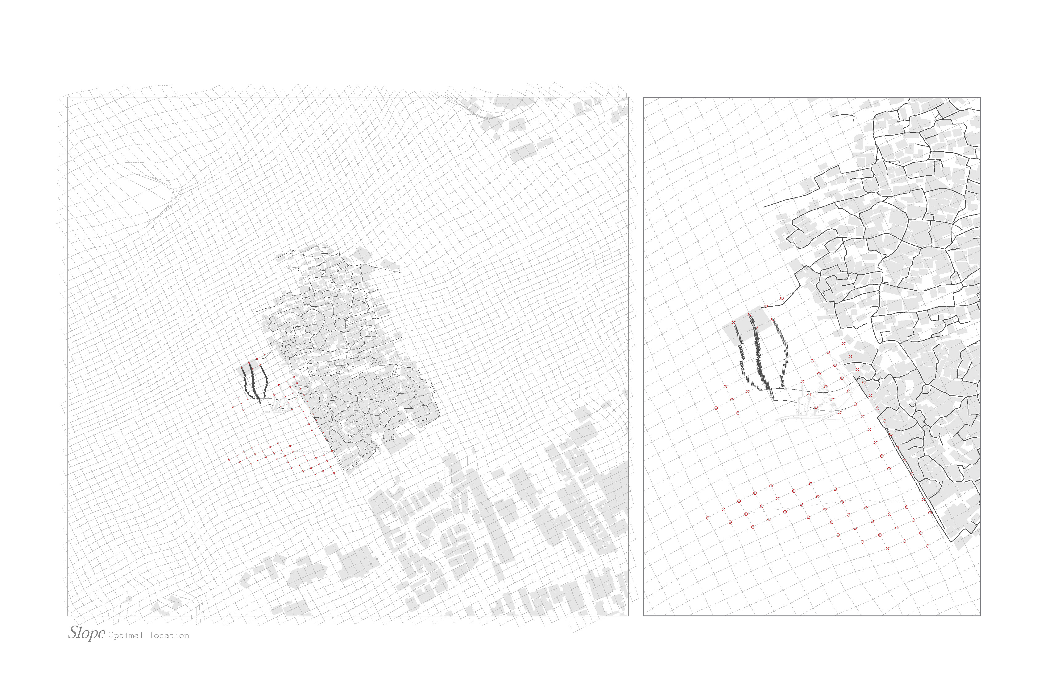
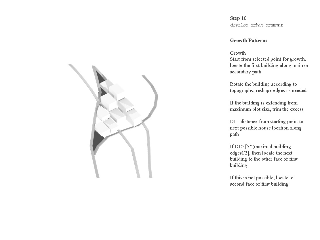
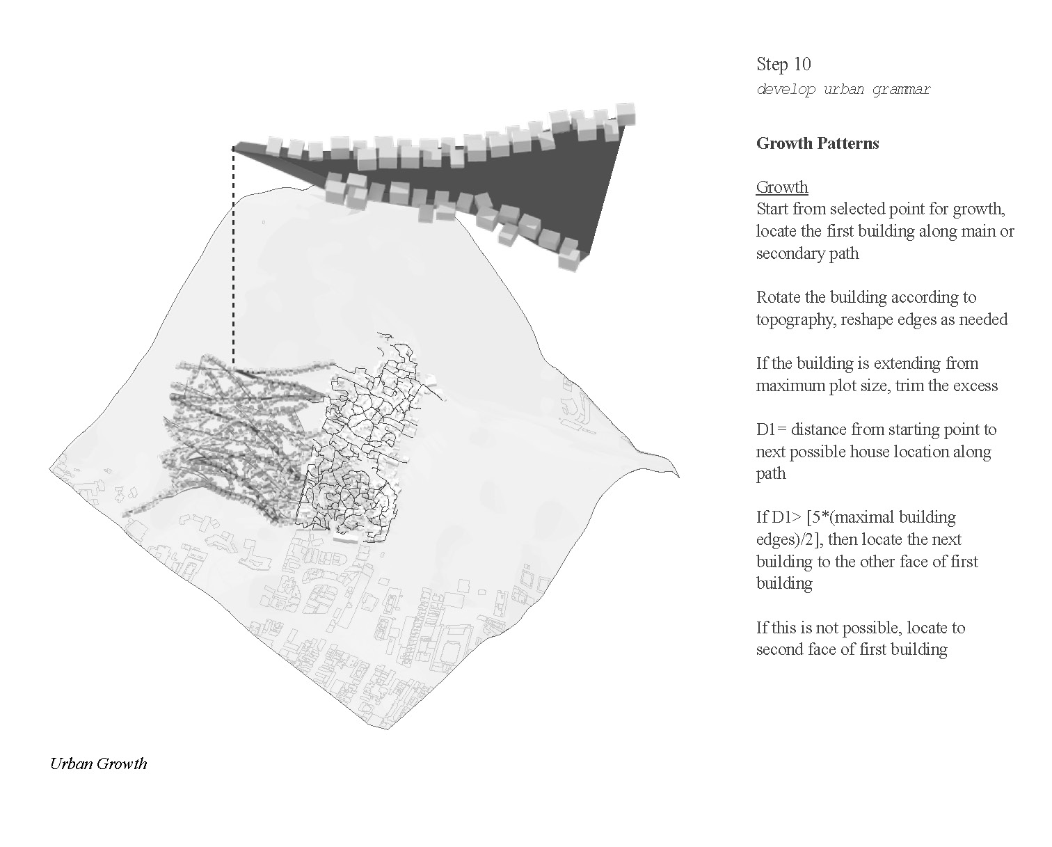
Applying the script
To accomplish these goals we propose a collection of rules. In order to maintain a sloping walking path without the need of need, one must establish points of departure and ending. From there a primary path can develop connecting the two in the most accessible way, less than 9%.
As an example the new favela begins at the base of Santa Marta. We use an existing path to connect our entrance. Then a public open space is located in an optimal slope location. From there a path is established to connect the two points. Buildings and homes act as infill from here and secondary paths can be introduced with stairs as needed. This pattern continues up the hillside. Each rule is a result of the existing topography and access points.
As an example the new favela begins at the base of Santa Marta. We use an existing path to connect our entrance. Then a public open space is located in an optimal slope location. From there a path is established to connect the two points. Buildings and homes act as infill from here and secondary paths can be introduced with stairs as needed. This pattern continues up the hillside. Each rule is a result of the existing topography and access points.
Map: Key development process
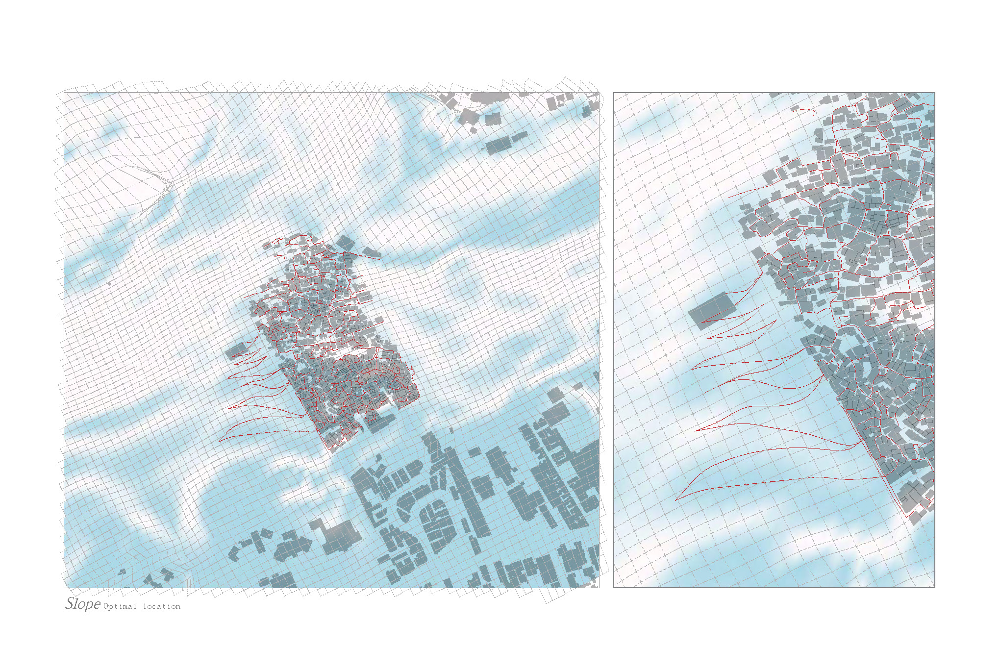
Map: The final pathway defined linking the existing route

Map: The final pathway with sceondary pathway system

Map: The script is applied on the original site
Axon: Visualizing the pathway with existing building
Incremental Strategy
This strategy is incremental and occurs overtime in an organic fashion. Thus infrastructure must be dealt with in a similar manner. We propose that with the addition of every primary path- water, electric, and sewage systems be installed in a manner that is cost effective and efficient.
Amenities like daycares, police stations and churches will act as points and are to be built incrementally according to growth of the favela. New amenities will be introduced like a nursing home, fire station, and health clinic. These additions are reference to the recommendations of the Rio de Janeiro Planning Commission.
Amenities like daycares, police stations and churches will act as points and are to be built incrementally according to growth of the favela. New amenities will be introduced like a nursing home, fire station, and health clinic. These additions are reference to the recommendations of the Rio de Janeiro Planning Commission.


Axon: Visualizing different housing density


The Final Presentation Package
Future Planning
Moving forward it is important to study the character of Santa Marta in more depth in order to establish accurate means of growth. We have learned that residents develop circulation paths to quickly to from point A to B. So for this strategy to be successful we must be mindful of how the space is organized to accommodate both social and functional needs while also limiting the creation of strict rules.