Atlas Port Terrain
Term Mahan Rykiel Associates
Course Design with Dredge: Resilient Landscape Infrastructure in the Chesapeake Bay
Instructor Isaac Hametz, Brian Davis
Partner Shi Chen, Julie Shapiro, Bryan McKnight
Every year in the Baltimore Harbor natural and anthropogenic siltation processes infill waterways and navigation channels, necessitating the removal of 1.5 million cubic yards of sediment to keep the port operating. The Design with Dredge research program brings together practitioners, community members, academics, regulatory and policy officials, and industry representatives to advance shared conceptual frameworks, planning priorities, and applied landscape strategies for resilient dredged material management in the Baltimore region.
Through cross-disciplinary collaboration, compound research methods, and direct stakeholder engagement the program provides a lens through which to explore emerging and future landscape infrastructure issues facing port cities and coastal communities. It also serves as a medium for material investigation and a cooperative paradigm for engaged civic action. In recasting the clays, silts, sands, and gravels of the Baltimore Harbor as a substrate of resiliency, Design with Dredge is catalyzing the institutional and operational energy and knowledge of diverse stakeholders to reimagine what it means to live in a dynamic urban estuary where legacies of labor, innovation, and ecological justice overlap.

Map: Shoreline change
“Port Terrain: A Baltimore Atlas of Industry” Research based design project. The research project aimed to understand the spatial extend of the Port of Baltimore and its industrial heritage in the world through its objects and landscape. Finding the relationship of the land, water, and infrastructure. Therefore, create a framework of how to structure and catalyze possibilities for future city.
* The project is published on LAM Landscape Architectural Magazine
* ASLA Professional Award 2018 ‘Design with Dredge: Resilient Landscape Infrastructure’
Link: Design with Dredge: Resilient Landscape Infrastructure in the Chesapeake Bay
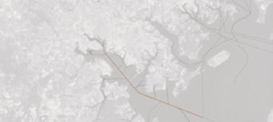

intermodalism: channel, interstate, train
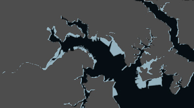
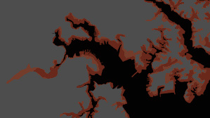

shifting shoreline:
shoreline change, sea-level change, combined
shoreline change, sea-level change, combined
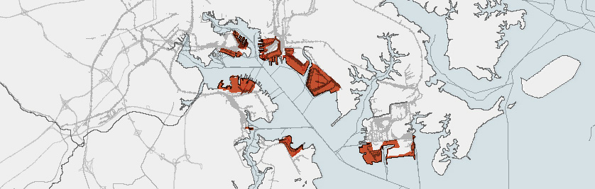
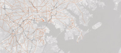
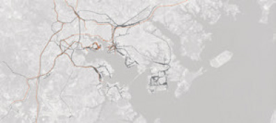
terminals in baltimore
Diagram: Logic of operations

Diagram: Scale of Terminals
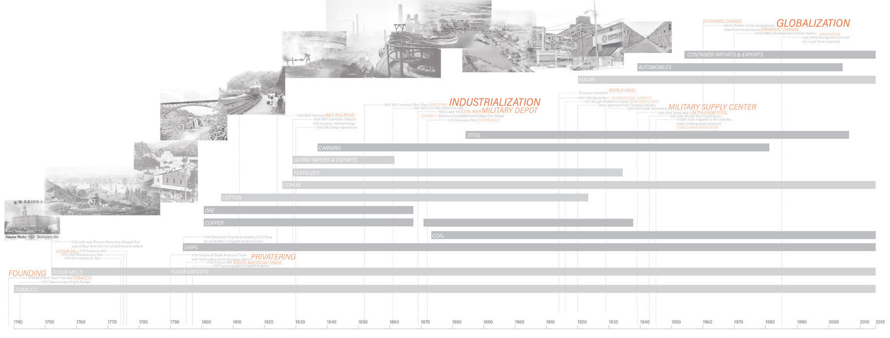
Timeline: Baltimore industrial history
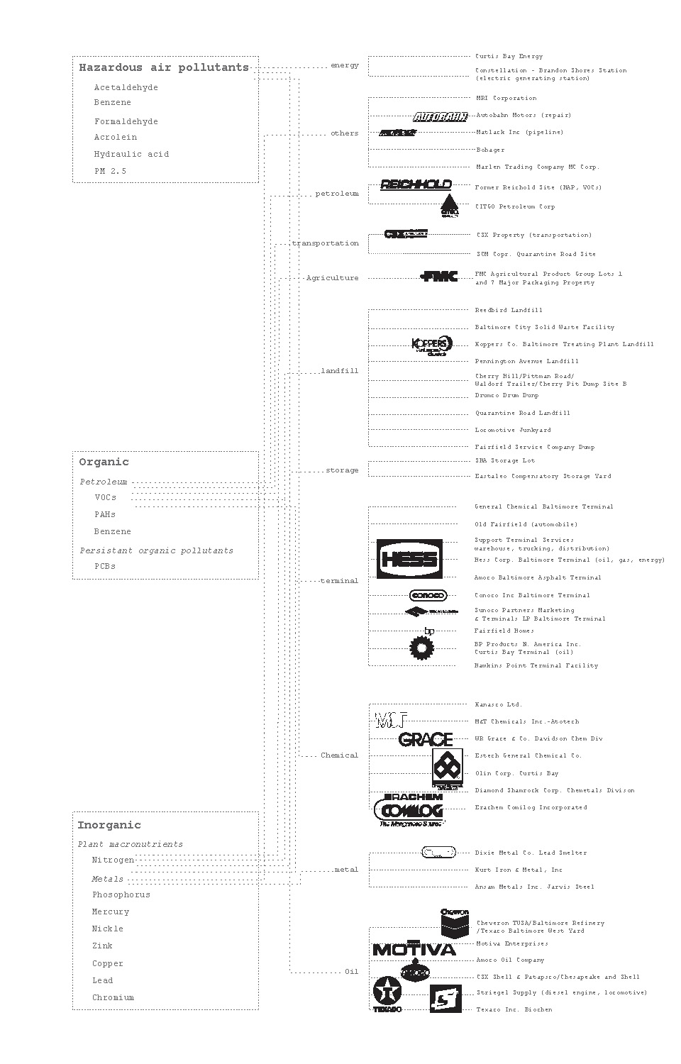
Diagram: pollutants and source

Map: pollution sources of Baltimore Port

Collage: pollution sources relating to the industry types